
- Mar 18
Understand Your Landscape Before You Design
- Mark Verschuur
- Spatial Design and Decision Making
Spatial analysis for regenerative land use
Designing agroforestry systems, food forests or regenerative farms starts with one question:
How does the landscape actually work?
Where does water accumulate?
Which slopes receive the most sunlight?
Where are the wet or dry zones?
How do terrain and microclimate shape ecological patterns?
RegenGIS helps you analyse these landscape processes using GIS-based spatial analysis.
Instead of guessing, you work with maps that reveal how the land functions.
The problem
Many regenerative projects start with:
satellite imagery
hand-drawn sketches
fragmented observations in the field.
But complex landscapes are shaped by spatial patterns such as:
topography
water flow
solar exposure
microclimate gradients.
Without analysing these patterns first, design decisions rely mostly on intuition.
That works for small gardens.
It becomes risky for hectares of land and long-term systems.
The RegenGIS approach
RegenGIS applies geographic information systems (GIS) to regenerative land design.
Using terrain data, satellite imagery and spatial modelling, RegenGIS reveals:
Terrain structure
slope
aspect
terrain curvature
relative elevation
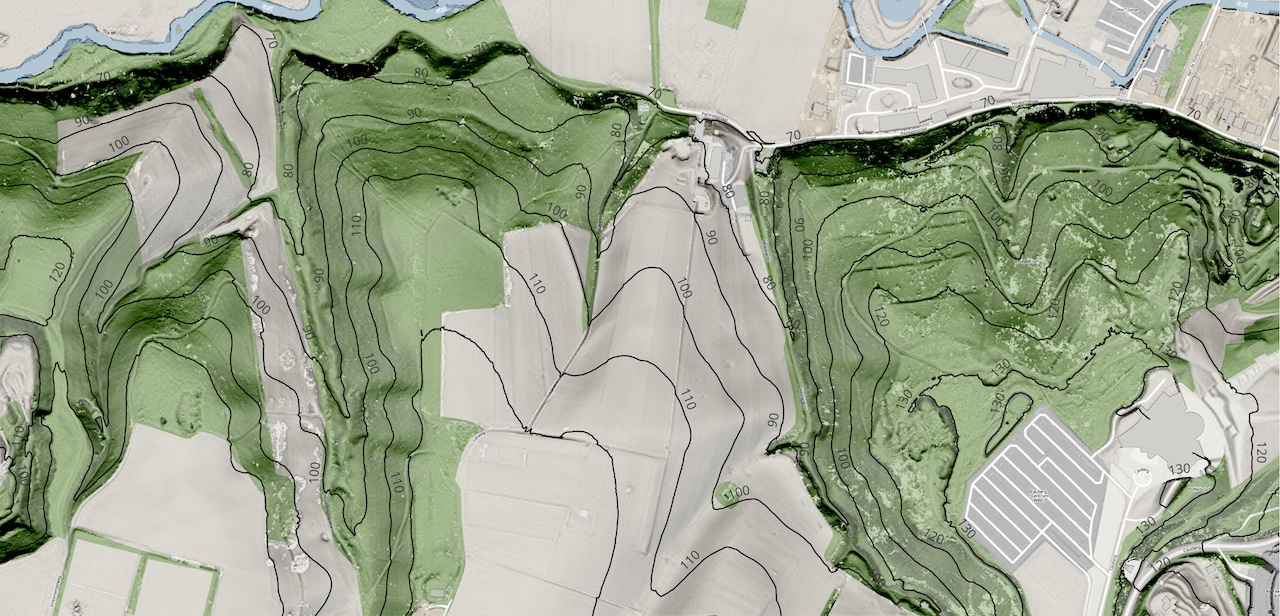
Height contours map
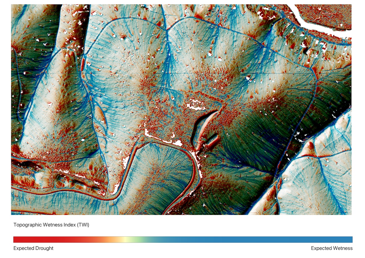
Water patterns
flow direction
flow accumulation
drainage networks
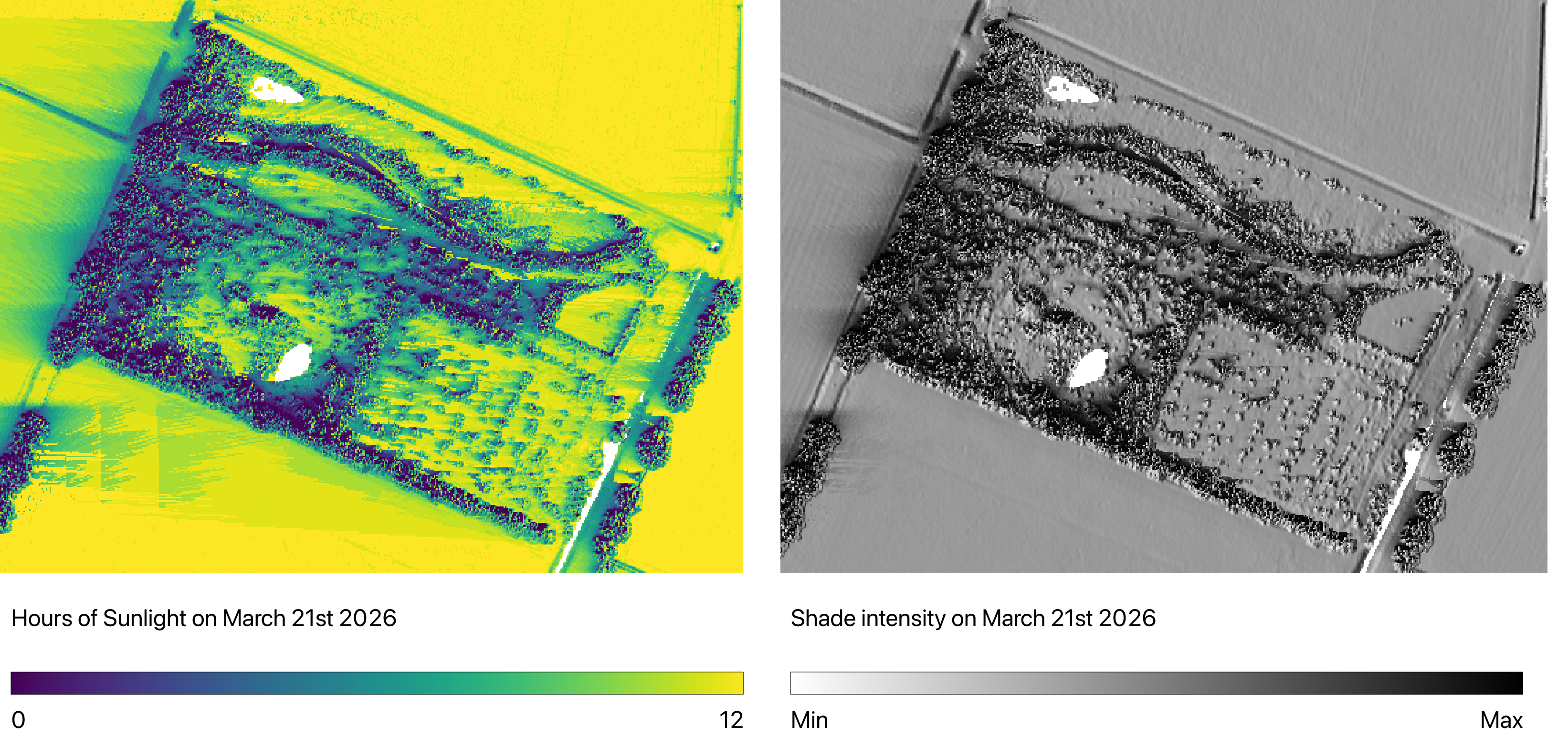
Microclimate
solar radiation
seasonal shading
terrain-driven microclimates.
The result is a set of clear analytical maps that help you read the landscape before making design choices.
What you gain
With RegenGIS you can:
understand how your landscape functions
identify water accumulation zones
detect sun and shade patterns
recognise terrain-driven microclimates
support ecological design decisions with spatial evidence.
These insights help designers work with landscape processes rather than against them.
Who this is for
RegenGIS is designed for:
agroforestry designers
food forest planners
regenerative farmers
landscape architects
ecological restoration projects.
Anyone working with complex landscapes can benefit from data-driven spatial understanding.

Get Early Access
RegenGIS tools and courses are currently being developed. If you want to explore how spatial analysis can support regenerative design, join the waiting list.
You will get early access to
the RegenGIS QGIS plugin
new learning resources
online courses about GIS in regenerative design
community discussions and experiments
Join the early access list now!